Transcript: Episode 15
Moongeeks by Dave Guild, Chapter 2, Intelligent Design, copyright 2009/2010 Dave Guild and Characters.
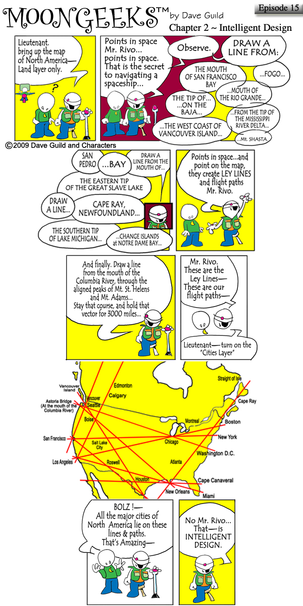
scene: Pilot Bolz is speaking to navigator in training, Mr. Rivo. The Lieutenant, the computer go to guy is in the background. //
caption: [Bolz] "Lieutenant. Bring up the map of North America-- Land layer only
caption: [Bolz] "Points in space Mr. Rivo... points in space. That is the secret to navigating a spaceship..." // "Observe." // "Draw a line from:"//
"The mouth of San Francisco Bay" // "...Mouth of the Rio Grande..." // "...Fogo..." // "The tip of..." "...on the Baja..." // "...The West coast of Vancouver Island..." // "...From the mouth of the Mississippi River delta..." // "...Mt. Shasta..." caption: [Bolz] "...Draw a line from the mouth of..." // "San Pedro" // "...Bay" // "The Eastern tip of the Great Slave Lake" // "Draw a line..." // "Cape Ray Newfoundland..." // "The Southern tip of Lake Michigan..." // "...Change Islands at Notre Dam Bay..."
caption: [Bolz] "Points in space... and points on the map, they create LEY LINES and flight paths Mr. Rivo."
caption: [Bolz] "And finally. Draw a line from the mouth of the Columbia River, through the aligned peaks of Mt. St. Helens and Mt. Adams... Stay that course, and hold that vector for 3000 (three thousand) miles..."
caption: [Bolz] "Mr. Rivo. These are the Ley Lines-- These are our flight paths--" // "Lieutenant-- turn on the "Cities Layer."
scene: A map of North America, with ley lines, and cities. // Caption: (Listed cities & locations) Vancouver Island (Canada), Vancouver, Edmonton, Calgary, Seattle, Astoria Bridge (at the mouth of the Columbia River), Boise, San Francisco, Los Angeles, Salt Lake City, Roswell, Houston, New Orleans, Miami, Cape Canaveral, Atlanta, Washington D.C., New York, Boston, Cape Ray, Straight of Isle, Montreal, and Chicago.
caption: [Mr. Rivo] "Bolz!-- All the major cities of North America lie on these lines & paths. That's Amazing--"
caption: [Bolz] "No Mr. Rivo. That -- is INTELLIGENT DESIGN."




.jpg "Click for full size.")